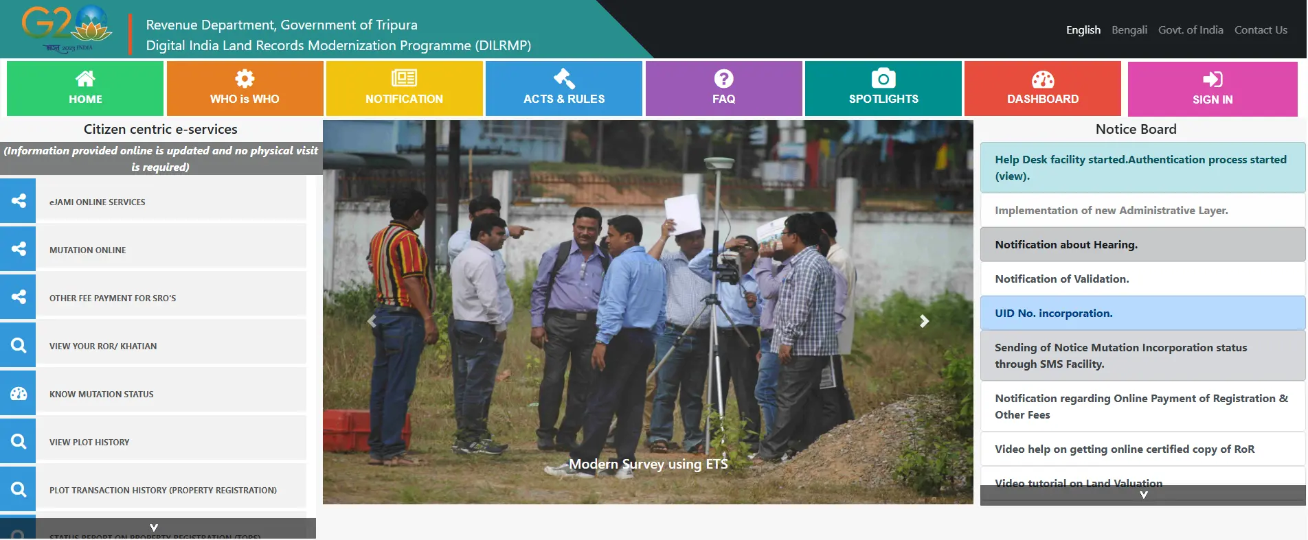
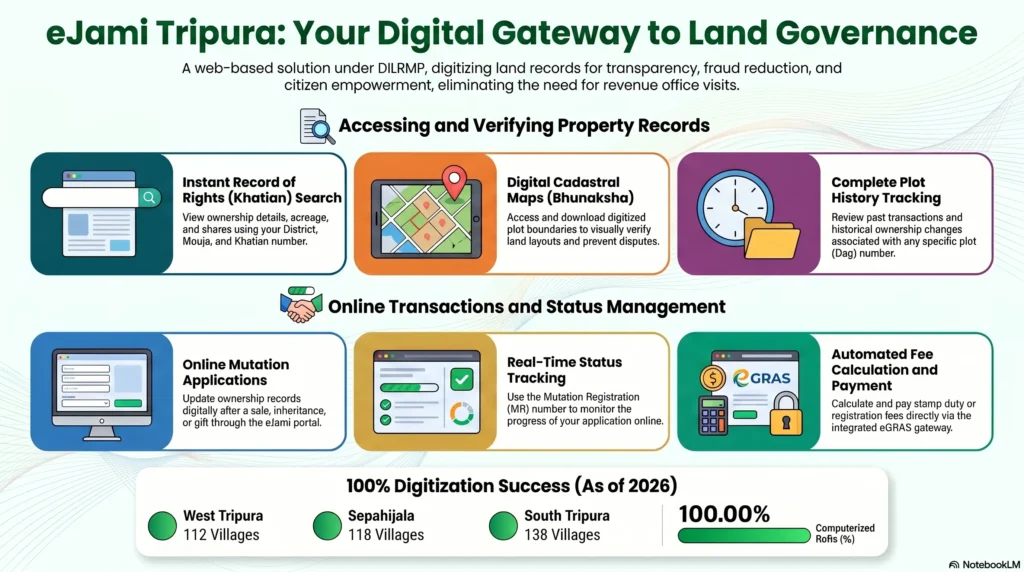
The administration of land in Tripura has reached a landmark milestone, with the state successfully achieving over 99% computerization of its Records of Rights (RoR). This transformation, moving from colonial-era manual ledgers to the digital eJami portal, represents a strategic shift in governance led by the Revenue Department in collaboration with the National Informatics Centre (NIC). For decades, land management was hampered by “information asymmetry,” where a lack of transparent data led to frequent disputes and administrative delays.
The eJami Land Records Management System (LRMS) serves as a web-based single-window solution that empowers citizens to verify titles independently and securely. By digitizing these records, Tripura has not only enhanced administrative efficiency but has also created a legal and economic infrastructure that protects property rights. This guide provides a comprehensive analysis of the portal, explaining how it fosters economic trust and reduces the risks of record tampering through sophisticated technical and legal safeguards.
What is eJami Tripura? Understanding the System
The eJami portal is a comprehensive web-based Land Records Management System (LRMS) that serves as the state’s primary engine for maintaining textual Record of Rights (RoR), cadastral maps, and settlement operations. Beyond a mere database, eJami is built upon two critical legal safeguards designed to mitigate civil litigation:
- The Mirror Principle: The digital record is designed to accurately reflect the physical reality of the land on the ground.
- The Curtain Principle: The record acts as the sole source of truth for the title, removing the burden from the buyer to investigate historical “pedigrees” to verify current ownership.
To maintain the absolute integrity of these records, the system utilizes a Maker-Checker-Approver workflow. Every entry or modification must be initiated by one official, verified by a second, and approved by a third, ensuring high-stakes administrative actions are accountable and transparent.
Dual-Platform Structure
The system is bifurcated into two distinct operational platforms to balance public accessibility with administrative security:
- Citizen Centric Platform: A public interface allowing users to preview their Khatian, track mutation requests, and access non-scaled maps without specialized credentials.
- Online Application Link: A restricted gateway for revenue officials. This platform requires biometric logging, a User ID, and a password to perform official tasks like approving mutations.
Navigating the Administrative Hierarchy
Land data in Tripura is organized in a nested hierarchy. Selecting these parameters accurately is essential for retrieving records on the portal:
- District: The highest administrative division (e.g., Unakoti, Khowai, or Sepahijala).
- Sub-Division: Regional divisions within a district (e.g., Teliamura).
- Revenue Circle: A functional unit specifically designated for revenue administration and oversight.
- Tehsil: The local administrative office responsible for maintaining village-level records.
- Mouja/Mouza: The administrative village unit that serves as the basis for cadastral mapping.
- Dag/Plot Number: The most granular identification, representing a unique parcel of land.
Core Services for Citizens
The eJami portal consolidates vital land services into a digital format, reducing the “compliance cost” and time for residents.
Viewing Records of Rights (Khatian/RoR)
The Khatian is the primary certificate of land ownership, listing registration IDs, acreage, and co-owner shares.
- Visit the official eJami website and select the “Khatian/ Plot based search” link.
- Select the District, Sub-Division, Revenue Circle, Tehsil, and Mouja from the dropdown menus.
- Choose the “Search by Khatian number” option, enter the number, and click “Display.”
Checking Mutation Status
Mutation is the process of updating ownership records after a property transfer.
- Navigate to the “Know Mutation Status” section.
- Input the required location details (District to Mouja).
- Select the “Search by MR Number” option and enter your Mutation Registration (MR) number to see the current stage of approval.
Viewing and Downloading Land Maps
Integrated with Bhunaksha software, the portal allows users to see visual representations of land boundaries.
- Select the “View Map” or “View PDF Map” option.
- Enter the location parameters and plot (Dag) number.
- The system generates a non-scaled PDF map available for download, useful for personal reference and boundary verification.
Plot History Search
This feature allows buyers to verify the “pedigree” of a land parcel by viewing past transaction history.
- Select the “View Plot History” service.
- Enter the specific Dag number and location details.
- Review past changes in ownership to ensure the land is free from undisclosed disputes or illegal transfers.
Tripura’s Unique Land Measurement Units
Tripura utilizes traditional land units that are integrated into the eJami system for local relevance. The portal provides automated tools to convert these into standard international units.
| Traditional Unit | Context and Role | Standard Conversion |
| Dhur | Used for small-scale land and residential plots. | Automated to Acres/Sq. Metres |
| Kranta | A local sub-unit for precise inheritance partitioning. | Automated to Acres/Sq. Metres |
| Kara | Essential for defining precise boundary demarcations. | Automated to Acres/Sq. Metres |
| Ganda | A traditional unit of area measurement in Tripura. | Automated to Acres/Sq. Metres |
| Krani | Local measurement unit used in legacy revenue records. | Automated to Acres/Sq. Metres |
The Land Mutation Process in Tripura
Mutation is legally mandated to ensure government revenue records reflect current ownership, governed by the Tripura Land Revenue and Land Reforms Rules, 1961.
A “High-Impact” feature of Tripura’s governance is the TORS integration. When a deed is registered at the Sub-Registrar’s Office via the Tripura Online Registration System (TORS), it can auto-trigger the mutation process, significantly reducing administrative delays.
Required Documents & Fees:
- Fees: A mutation charge of approximately INR 25 (state share) is typically paid online.
- Documentation: Scanned copies of the sale deed, identity proof (Aadhaar/PAN), and recent land tax receipts.
Official Portal vs. Third-Party Information
While real estate blogs like MagicBricks or SquareYards provide helpful “handy guides” and EMI calculators, they cannot perform administrative actions or provide legal documents.
| Feature | Official eJami Portal | Third-Party Blogs |
| Legal Validity | High; Provides Digitally Signed, Court-Valid documents. | None; For informational reference only. |
| Direct Mutation Filing | Yes; Direct application and fee payment. | No; Only provides instructional guides. |
| Home Loan Tools | Limited to registration fee calculators. | Extensive; Includes EMI and eligibility tools. |
| User Experience | Formal, procedural, and technical. | Consumer-centric and simplified. |
Economic and Social Impacts
The digitization of land records has transformed Tripura’s socio-economic landscape:
- Financial Inclusion: By providing instant, independent title verification, eJami allows banks to streamline farm and home loans, removing the need for physical “gatekeepers.”
- Indigenous Community Empowerment: Transparent digital records protect tribal lands from illegal alienation. Communities can use ICT records to prove traditional claims and block unauthorized transfers.
- Gender Inclusion: The introduction of a specific “Gender Column” in the RoR allows the state to monitor and promote female land ownership, enhancing women’s economic security.
Technical Specifications & Mobile Access
The technical backbone of eJami consists of a PostgreSQL database augmented by the PostGIS spatial module to manage complex plot geometry. For mobile access, the Jami Pariseva app supports workflow-based mutation and real-time retrieval of land info.
The state is currently implementing the 14-digit ULPIN (Bhu-Aadhar). This “Unique Land Parcel Identification Number” identifies land based on specific geo-coordinates, ensuring near-total prevention of “benami” or fictitious transactions.
Conclusion
The transformation of Jami Tripura from manual ledgers to the digital eJami portal is a cornerstone of modern governance. By achieving 99% computerization and integrating technical modules like PostGIS, Tripura has converted land from a dispute-prone asset into a transparent economic engine. Whether for a farmer seeking credit or a homebuyer verifying a title, the portal provides the transparency required for secure economic participation. For all official needs, residents are encouraged to visit jami.tripura.gov.in.