Introduction: The Digital Evolution of Delhi Land Records
The administration of land within the National Capital Territory (NCT) of Delhi has historically been a complex, manual, and often opaque process. However, we have entered a new era of digital governance. The Delhi Land Records Computerisation (DLRC) project—formerly known as Indraprastha Bhulekh—is the official online portal maintained by the Revenue Department of the Government of NCT of Delhi. This platform represents a monumental shift away from the traditional “Patwari-office monopoly,” providing citizens with direct access to critical property data.
The 2026 Vision: Transparency and Fraud Prevention
As a Senior Real Estate Compliance Expert, I have observed how the lack of accessible records previously fostered an environment ripe for data manipulation and corruption. The Delhi Government’s 2026 vision is centred on the absolute digitisation of land parcels to eliminate these risks. By integrating high-resolution drone surveys and sophisticated geospatial technology, the state is building a transparent framework where property boundaries are beyond dispute. This system is designed to protect your life savings by ensuring that every transaction is backed by verifiable, real-time government data. We welcome all landowners and prospective buyers to engage with this portal as their primary tool for due diligence and property management.
Essential Terminology for Delhi Property Owners
To effectively navigate the DLRC portal and understand the legal status of your assets, you must be familiar with the following technical terms used in the Delhi Revenue Department:
- ROR (Record of Rights): The master document for land ownership. It serves as the primary legal evidence of an individual’s or entity’s rights over a specific parcel of land.
- Khata/Khewat Number: An account number allocated to an owner or a group of family members who possess a shared interest in the entire land area of a specific holding.
- Khasra Number: A unique identification number assigned to each parcel of land, particularly in rural and semi-urban areas. It is essentially the “plot number” used for revenue purposes.
- Jamabandi: A historical document of cultivation and ownership. Under the Punjab Land Revenue (PLR) Act, these records are updated every five years (a quinquennium) by the Patwari and attested by revenue authorities.
- Khatauni: This document provides granular details regarding the cultivator’s holdings, including the nature of the tenancy and the specific area under cultivation.
- Bhu-Aadhaar (ULPIN): The Unique Land Parcel Identification Number. This 14-digit alphanumeric code acts as a permanent, digital identity for every plot, pinning it to exact geospatial coordinates.
Step-by-Step Guide: How to Check Delhi Land Records Online
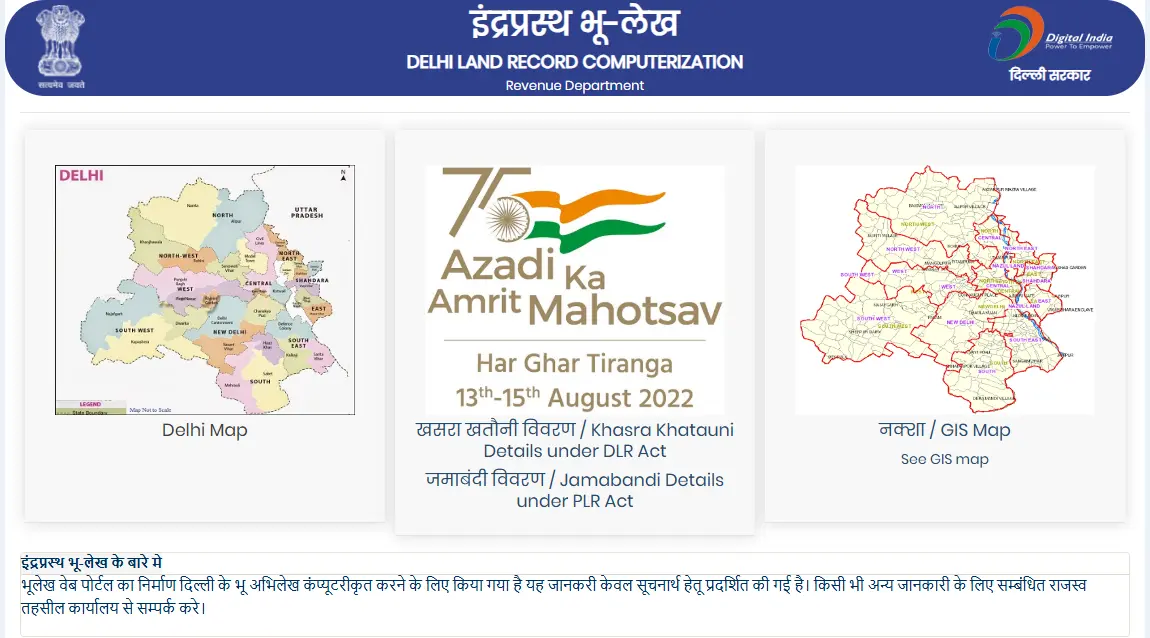
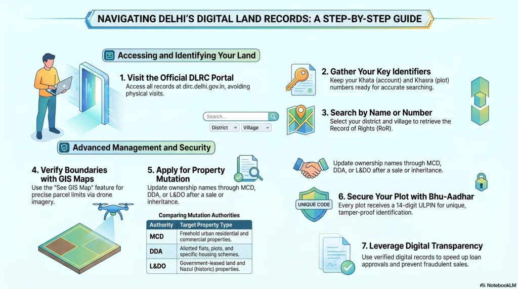
The official gateway for these records is https://dlrc.delhi.gov.in/. The portal provides different access points depending on whether the land falls under the Delhi Land Reforms (DLR) Act or the Punjab Land Revenue (PLR) Act.
1. Accessing the Portal
Begin by navigating to the official DLRC homepage. You will find clear options for “Khasra Khatauni Details” and “Jamabandi Details.”
2. Search by Owner Name
If you do not have specific parcel numbers, follow this procedure:
- Log in to the official DLRC website.
- On the homepage, select your specific District and click on “View Records.”
- A new window will appear; fill in the Subdivision, Village, and Khata Type.
- Select the search criteria “By Name” and enter the owner’s name in the text box.
- Click on “View Khata Details.” The system will display all registered holdings associated with that name.
3. Search by Khasra Number
To locate the Record of Rights (ROR) for a specific plot:
- Select the “Khasra Khatauni Details” link on the homepage.
- Click “View Records” next to the relevant district.
- Input the village and the type of Khata (e.g., Agricultural or Non-Agricultural).
- Select the option “By Khasra Number” and enter the unique parcel ID.
- Click “View Khata Details” to generate the digital ROR report.
4. Search by Khata Number
To search via the account/holding number:
- Navigate to the Khasra Khatauni details section.
- Enter the geographical parameters (District, Subdivision, and Village).
- Choose the “By Khata Number” option from the dropdown menu.
- Input the Khata/Khewat number and click “View Khata Details.”
5. Accessing Jamabandi Specifics (PLR Act)
For records updated under the PLR Act, use the following 4-step method:
- On the DLRC homepage, click the link for “Jamabandi Details.”
- Select “Jamabandi Details under PLR Act.”
- Choose your District and click “View Records.”
- Select the Village, enter the Jamabandi number, and click “View Detail.”
Visualising Property: GIS Maps and High-Resolution Surveys
The integration of Geographic Information System (GIS) mapping is a cornerstone of Delhi’s modernization. It allows users to correlate textual ownership data with visual boundaries.
Procedure for Accessing GIS Maps
- On the DLRC portal, click the “See GIS Map” button located on the interactive map graphic.
- You will be redirected to the map interface. Use the zoom tools to locate your property.
- Select the “Khasra Information” tab at the top of the screen.
- Enter the required details: State, District, Division, Village, and Rectangle.
- Click “View Ownership Details.” The map will highlight the parcel, showing its dimensions and relative position.
Expert Insight: “Broken Lines” and 3D Modernisation
As a compliance expert, I advise property owners to pay close attention to the visual markers on these maps. According to the Land Record Manual (Paragraph 4.13), where a boundary of a survey number is known but not physically marked on the ground (due to rich cultivation or sandy soil), it is delineated on the map by broken lines. Identifying these is crucial for understanding potential boundary disputes.
Furthermore, the 2024–2026 drone survey initiative by the Delhi Government is currently creating a sophisticated 3D geospatial database. This initiative goes beyond surface-level mapping, capturing two and three-dimensional information of both underground and overground assets. This ensures that utilities, encroachments, and infrastructure are mapped with centimetre-level accuracy.
The Bhu-Aadhaar Revolution: 14-Digit ULPIN
Delhi has successfully implemented the Bhu-Aadhaar project, assigning a 14-digit Unique Land Parcel Identification Number (ULPIN) to every plot.
- Definition: Bhu-Aadhaar is a permanent, digital identity for land, similar to an individual’s Aadhaar card.
- Strategic Benefits:
- Fraud Elimination: By pinning every parcel to exact longitude and latitude coordinates, it prevents land mafias from selling the same plot multiple times.
- Legal Resolution: It provides a verifiable digital history, helping to clear legal battles that have lasted decades.
- Financial Facilitation: Precise geospatial pinning allows banks to verify land as collateral instantly, speeding up home and plot loan approvals.
- Current Status: Following a successful pilot in Tilangpur Kotla, the IT branch of the Revenue Department is collaborating with the Survey of India to roll this out across all 22 sub-registrar jurisdictions.
Property Mutation and Registration Policies
The Mutation Process
Mutation is the formal process of transferring a property’s title in government records. It is essential for establishing tax liability and legal ownership. In Delhi, mutation is handled by three authorities:
- MCD (Municipal Corporation of Delhi)
- DDA (Delhi Development Authority)
- L&DO (Land and Development Office)
Online Mutation Certificates
Citizens can download their mutation certificates from the MCD website (mcdonline.nic.in):
- Navigate to the “Download Mutation Certificate” option.
- Enter the registration number, date of transaction, and the SRO office.
- Complete the captcha and click “Search” to retrieve the digital certificate.
Document Checklist for Property Mutation
To ensure a successful mutation, the following documents are required:
- Copy of the registered Sale Deed.
- No Objection Certificate (NOC) from the housing board.
- Indemnity Bond on Rs. 100 stamp paper (duly attested).
- Undertaking Form from the transferee on Rs. 10 stamp paper.
- Property Tax Clearance receipt.
- Fees: Apportionment fee of Rs. 100 and a composition fee of Rs. 50.
- For Inherited Property: Death certificate of the previous owner and a copy of the Will.
- For Power of Attorney (POA) Cases: Power of Attorney papers and proof of payment registered with the sub-registrar.
The “Anywhere Registration” Policy
In a strategic move to break the local “Patwari-office monopoly” and reduce administrative chaos, Delhi has introduced the Anywhere Registration Policy. Residents are no longer restricted to the specific sub-registrar’s office of their locality. Instead, they can book an appointment at any of the 22 sub-registrar offices in Delhi via the National Generic Document Registration Service (NGDRS) portal. This distributes the workload, reduces backlogs in crowded areas like Pitampura and Janakpuri, and ensures a faster, more professional experience for homebuyers.
Benefits of Digitised Land Records
- Transparency: Digital records eliminate the need for middlemen and drastically reduce the potential for manual data tampering.
- Efficiency: Landowners can access their data within minutes from their own homes, avoiding long queues at revenue offices.
- Fraud Reduction: Prospective buyers can verify the authenticity of a plot and its ownership history before making any financial commitment.
- Financial Inclusion: Lenders and banks use ROR reports and Jamabandi details as a mandatory requirement for loan approvals.
- Cost-Free Access: Viewing records for information on the DLRC portal is free, allowing owners to track their assets periodically without expense.
Competitor Analysis: Delhi vs. Other States
While India is undergoing a nationwide digitisation of land records, Delhi’s DLRC portal is uniquely focused on the 3D mapping of a high-density urban environment.
| Portal Name | State | Key Unique Feature |
| DLRC / Bhulekh Delhi | Delhi | 14-digit Bhu-Aadhaar (ULPIN) and 3D geospatial drone surveys of urban assets. |
| Meebhoomi | Andhra Pradesh | Extensive focus on land conversion tracking and integrated ROR. |
| Jamabandi Haryana | Haryana | Strong emphasis on historical Jamabandi and lineage tracking. |
| MP Bhulekh | Madhya Pradesh | WebGIS 2.0 integration for real-time Khasra Khatauni updates. |
| Banglarbhumi | West Bengal | Large-scale digitisation covering both agricultural and industrial plots. |
Legal Framework: The Land Record Manual & Service Rules
The governance of land in Delhi is rooted in the Punjab Revenue Patwaris, Class III Service Rules, 1966, which have been adapted for the NCT of Delhi. This framework ensures a disciplined hierarchy and strict adherence to administrative procedures.
1. Administrative Hierarchy
The Revenue Department operates under a defined chain of command:
- Director of Land Records: The Head of the Department, responsible for the Revenue Training School and the overall establishment of Kanungos and Patwaris.
- Commissioner: Responsible for disposing of inspection reports and overseeing general revenue administration.
- Collector / Deputy Commissioner: The primary authority for district-level appointments and the maintenance of the Register of Patwari Candidates.
- Kanungos (District, Office, and Field): The supervisors of Patwaris. A Field Kanungo must visit each Patwari circle monthly to ensure systematic record-keeping.
- Patwaris: The frontline officials responsible for crop inspections (Girdawari), maintaining the Roznamcha (diary), and preparing the Jamabandi.
2. Rules of Service and Conduct
To prevent corruption, the Service Rules impose strict regulations on revenue officials:
- Qualifications: Candidates must be between 17 and 25 years old and hold a Matriculation or Higher Secondary certificate, preferably with Agriculture.
- Training Curriculum: Before being commissioned, a Patwari must complete one year at the Patwar School. The curriculum includes Arithmetic, Mensuration (based on the Patwaris Mensuration Manual), the Land Record Manual (Chapters 3, 4, 7, 9, 10, and 18), and the Consolidation of Holdings Act, 1948. This is followed by six months of practical field training.
- Strict Prohibitions (Rule 17): A Patwari is strictly forbidden from engaging in trade, lending money to agriculturists, or purchasing land at auction within their jurisdiction. Furthermore, they are prohibited from acting as intermediaries for legal practitioners.
- Disqualifications: Under the rules, individuals with more than one living spouse are ineligible for service, ensuring a high standard of personal conduct.
3. The Patwari Diary: Para 3.81 Requirements
A critical duty of the Patwari is maintaining the Roznamcha Waqiati (Village Diary). Landowners should verify that the following 20+ occurrences are recorded, as these entries form the basis of the digital record:
- Calamities or epidemics affecting humans, crops, or livestock.
- Alluvion or diluvion (land gained or lost due to river action).
- Rainfall details (slight, medium, or heavy).
- Deaths of owners, pensioners, or revenue assignees.
- Marriages or re-marriages of females drawing family pensions.
- Changes in cultivating occupancy or rent.
- Execution of court decrees affecting land or produce.
- Takavi loans (government agricultural loans) and their repayments.
- Orders received from revenue officers.
- Attachment proceedings by courts.
- Encroachments on government or nazul property.
- Alienation or resumption of revenue.
- Cultivation of groves held free of revenue.
- Neglect of conditions attached to government grants.
- Erection, destruction, or decay of survey marks.
- Payments of revenue to the government.
- Visits of any revenue officers.
- Any important facts reported by interested persons.
- Cases of brick-burning or suspected incendiarism.
- Increases in mortgage money.
4. Technical Mensuration: The “Adda” and Official Fees
Expert compliance requires an understanding of how land is actually measured. According to Chapter 4 of the Manual, a standard length called an “Adda” must be marked out in every village. This is a level piece of land where a standard 20-metre chain is tested against two pegs driven 60 centimetres deep into the ground.
Citizens should also be aware of the official fees to avoid overpayment:
- Jamabandi/Khatauni Extracts: 60 Paise per Khatauni holding (for the first 8 holdings).
- Khasra Girdawari: 60 Paise for entries in a single volume relating to one field.
- Inspection Fee: Rs. 1.15 for inspecting papers relating to one quinquennium (five-year period).
- Tracing of Field Maps: A minimum charge of 60 Paise for any tracing work.
- Copying Fee (Sub-Inspectors): 60 Paise for cooperative society inspections.
Frequently Asked Questions (FAQ)
1. What is the full form of DLRC and its primary objective?
DLRC stands for Delhi Land Records Computerisation. Its objective is to provide a digitised, transparent, and secure platform for accessing land records (ROR, Khasra, Khatauni), thereby reducing corruption and saving citizens’ time.
2. What does a “Broken Line” signify on a Delhi GIS Map?
According to Paragraph 4.13 of the Land Record Manual, a broken line on a survey map signifies a boundary that is known and legally established but is not currently marked by a physical boundary (like a fence or wall) on the ground, often due to sandy soil or intensive cultivation.
3. How does the “Anywhere Registration” policy benefit me?
This policy allows you to book a property registration appointment at any of the 22 sub-registrar offices in Delhi. It breaks the previous monopoly of local offices, allowing you to choose an office with less backlog, thus speeding up the registration of your Sale Deed or Power of Attorney.
4. What are the specific duties of a Field Kanungo regarding my records?
The Field Kanungo is responsible for the work of Patwaris in their circle. They must visit each circle monthly and are required to check 25% of the entries in the Jamabandi and 25% of the mutations to ensure that the Patwari has accurately reflected changes in ownership or land status.
5. Are there restrictions on what a Patwari can do in my village?
Yes. Under Rule 17 of the Service Rules, a Patwari cannot engage in trade, lend money to farmers, or purchase land at a government auction. They are also prohibited from introducing residents to specific lawyers or acting as legal intermediaries.
6. What is the significance of the 14-digit ULPIN?
The ULPIN, or Bhu-Aadhaar, is a 14-digit number that provides a unique identity to your land parcel based on its exact longitude and latitude. It is used to prevent the double sale of the same plot and simplifies the process of obtaining bank loans and settling property disputes.
Conclusion
The digitisation of Delhi’s land records through the DLRC portal is a transformative achievement in urban governance. By replacing outdated manual registers with a high-resolution, drone-surveyed 3D database and 14-digit Bhu-Aadhaar identification, the Delhi Government has provided a robust shield against real estate fraud.
As a property owner, your due diligence is your first line of defence. Understanding the legal framework—from the intricacies of the Patwari’s diary to the “Anywhere Registration” policy—empowers you to navigate the market with confidence. We strongly urge every resident to visit the Bhulekh Delhi portal today to verify their property status. Protecting your assets begins with ensuring your Record of Rights is accurately reflected in the digital age.